Tôi ko biết điều gì làm bạn vui thú nhất, với tôi, đó là neo thuyền, cắm trại bên một vịnh biển hoang vắng, ko thể đến được bằng phương tiện gì khác ngoài thuyền… Như thế bạn được an toàn khỏi “văn minh hiện đại”, ít nhất là trong một thời gian!

Tôi ko biết điều gì làm bạn vui thú nhất, với tôi, đó là neo thuyền, cắm trại bên một vịnh biển hoang vắng, ko thể đến được bằng phương tiện gì khác ngoài thuyền… Như thế bạn được an toàn khỏi “văn minh hiện đại”, ít nhất là trong một thời gian!
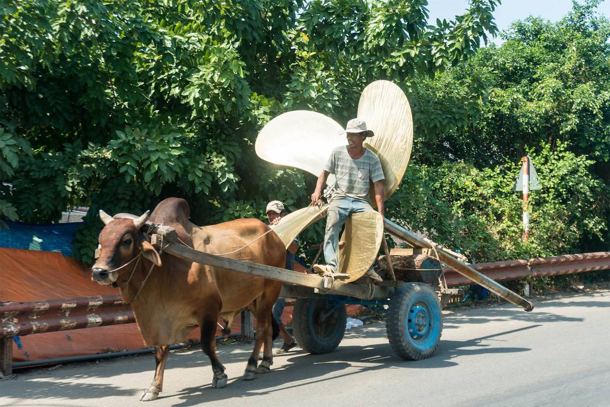
Lại thêm một hành trình đi suốt chiều dài của đất nước hình chữ S này nữa. Ban đầu, tôi dự tính một hành trình bằng xe đạp, với mong muốn đi thật chậm, nhưng tính đi tính lại, thời gian không có nhiều, nên xe máy vẫn là phương tiện tốt để thăm thú đó đây, chủ động trên mọi mặt. Cốt yếu một điều rằng, chưa bao giờ tôi nghĩ mình đã biết đủ về đất nước này, dù cho bao nhiêu vẻ nghèo nàn lạc hậu mà nó thể hiện, thì trong suy nghĩ của mình, dải đất này vẫn đầy tính đa dạng văn hoá và sinh học!
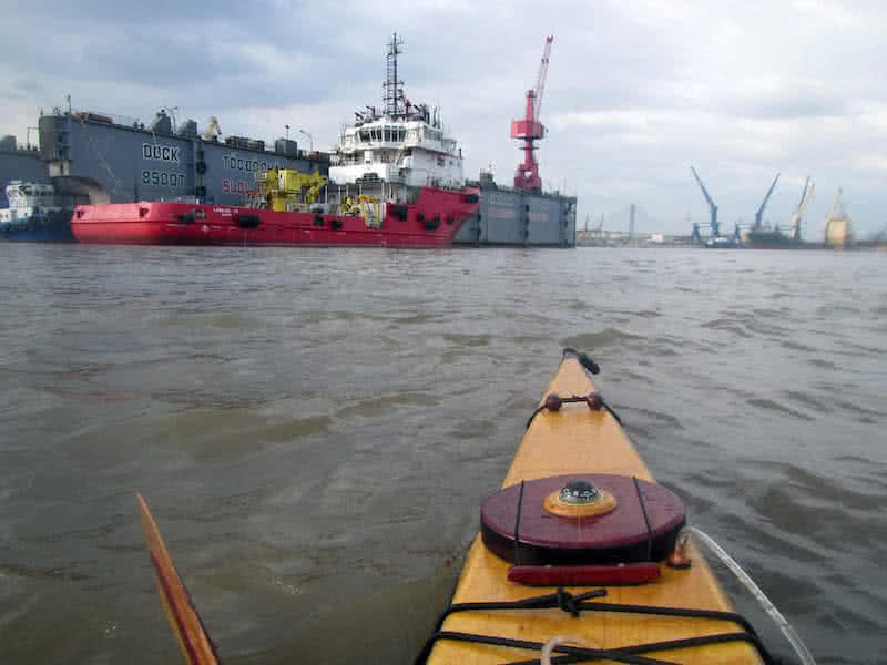
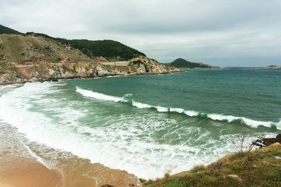
Hành trình bắt đầu từ Vũng Tàu, đi ngược ra Bắc bằng con đường ven biển. Hệ thống đường quốc phòng ven biển hoàn thiện trong những năm gần đây phát lộ ra nhiều cảnh quan, nhiều góc nhìn mới. Trước đây, trong cái nhìn của mình, tôi nghĩ rằng biển Đà Nẵng hay Nha Trang là đẹp nhất, đến giờ có lẽ điều đó không còn đúng nữa. Hành trình cũng có một mục đích khác: thăm dò tất cả những điểm quan trọng dọc bờ biển, chuẩn bị cho một chuyến xuyên Việt bằng thuyền kayak nào đó trong tương lai!
Thực ra, ngay lúc này đây, tôi cũng không chắc là bao giờ sẽ tổ chức được một hành trình kayak như thế, nhưng thầm nghĩ trong đầu, cứ chuẩn bị dần dần, từ từ từng ít một, lúc nào đó mình sẽ làm được! Từ tp. biển Vũng Tàu, băng qua sông Cỏ May, đi ven biển dọc theo Long Hải, Phước Hải. Ghi chú lại vị trí những bờ kè bê – tông chắn sóng. Ngay từ điểm này, bờ biển đã mang tính chất của biển miền Trung, cát trắng, biển trong, ít phù sa. Đi dọc cửa sông Ray về hướng Hồ Cốc, Hồ Tràm, Bình Châu.
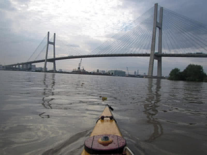
Con đường ven biển đoạn này rất tốt, rộng, bằng phẳng, đi qua những vùng cây cối ít nhiều xanh tươi, bãi cát trắng tinh sáng mờ trong ánh bình minh. Chẳng mấy chốc đã đến tx. Lagi, Bình Thuận, thời tiết nắng đẹp, mặt biển trong xanh sáng lấp lánh, sông Dinh chỉ là một con sông nhỏ, nhưng cảng cá ở đây khá lớn, cửa sông Dinh tàu neo đậu san sát, đi lại tấp nập! Tiếp tục ghi nhận những vị trí đá ngầm (rạng) dọc bờ biển, và những nơi có thể cập thuyền dọc theo bờ đê chắn sóng và bờ kè ven sông.
Từ tx. Lagi, lại theo tỉnh lộ 709, 719 chạy dọc bờ biển, chạy dọc theo sông Phan (một con sông bé) rồi vòng đến mũi Kê Gà (đến lạ, đã Kê lại còn Gà). Hải đăng mũi Kê Gà nằm trên một hòn đảo nhỏ, cách bờ chỉ tầm 200, 300 mét. Rồi lại chạy dọc theo đường 719 đi thành phố Phan Thiết. Một thành phố nho nhỏ, xinh xinh, yên bình, hãy còn mang dáng dấp một đô thị thời Pháp thuộc. Toàn bộ thành phố Phan Thiết xưa nằm gọn giữa hai con sông, hai cảng cá: sông Cà Ty và sông Phú Hài.


Dù là bánh xe lớn (Đại thừa) hay bánh xe nhỏ (Tiểu thừa), cứ đi khắc sẽ đến, hãy cứ tinh tấn mà tiến tới…
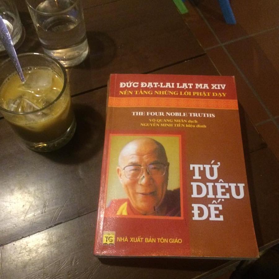
Có nhiều người cứ mãi huyên thuyên về giáo lý nhà Phật, những câu chuyện “trít học” rẻ tiền không ko biết nhặt được ở đâu hay tự ngồi bịa ra, thậm chí đã trót bịa ra rồi cũng không ráng bịa luôn cái “dẫn nguồn từ…” (sách nào, kinh nào!?) cho nó có vẻ đúng đắn! Khi được hỏi “Tứ diệu đế” là gì, “Bát chính đạo” là gì thì không trả lời được!
Mới là vỡ lòng của giáo lý Phật môn! Cái “chính” đầu tiên trong “Bát chính đạo” (8 con đường đúng đắn) là “Chính kiến”, tức là: biết đúng, hiểu đúng. Ko biết, hiểu đúng thì mọi thứ khác… vất đi! Hình như Đức Phật cũng đã tiên đoán đúng về thời kỳ Mạt Pháp! Ấy chính là cái thời kỳ nơi nơi xây chùa đắp tượng, nhà nhà mặc cà sa tụng kinh!
Tôi nói thế này nhé, chỉ e rằng trong vài tấm hình, vài dòng chữ, mọi người không hình dung ra hết được! Hành trình chèo kayak hàng chục nghìn km trong hơn 6 năm từ Đức đi Úc này, so với hành trình thỉnh kinh của Đường Tăng ấy, nó xa hơn nhiều lần, mà khó khăn và nguy hiểm cũng hơn nhiều lần. Mà Đường Tăng đi còn có biết bao nhiêu đệ tử đi theo hỗ trợ, còn Sandy Robson đi chỉ có một mình…
Chiều chiều ngồi trông ra khơi mờ xa.
Từng đàn chim bay trong ánh hoàng hôn…
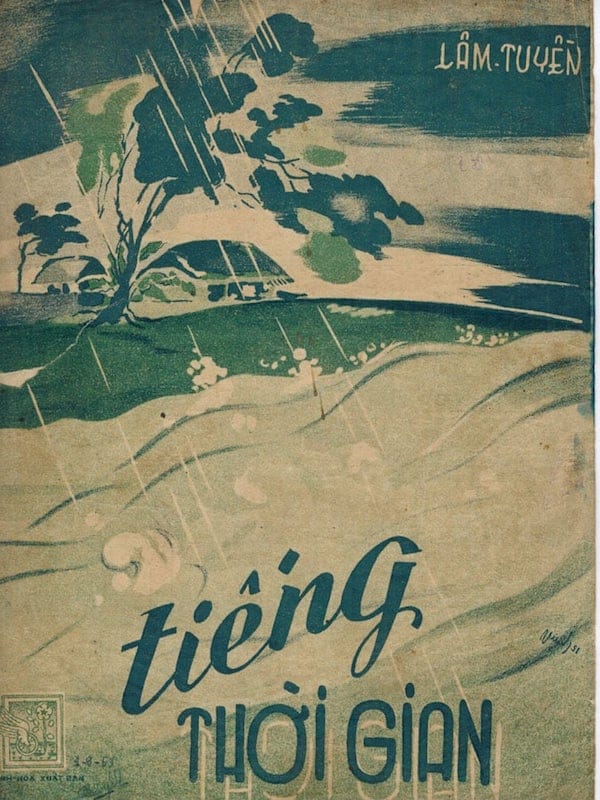
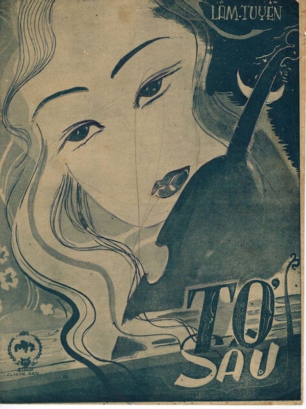
Nhạc của Lâm Tuyền có nét riêng, mang màu sắc nhạc thuật, cũng từ một không gian và thời gian của Nguyễn Hữu Ba, Lê Quang Nhạc, Văn Giảng, etc… mà ra, nên có lẻ “hợp gu” các cụ Hoàng Trọng, Văn Phụng, Vũ Thành, Nghiêm Phú Thi… Mí lại các vị ấy hãy còn cố gắng gìn giữ một đường lối âm nhạc mang tính giáo dục thẩm âm, định hướng thẩm mỹ trên sóng radio. Cá nhân tôi thấy âm nhạc của ông khá nhàm chán (thêm nữa số lượng sáng tác còn lại cũng không nhiều), riêng Khúc nhạc ly hương qua giọng ca Thái Thanh là một kỷ niệm thủa nhỏ!


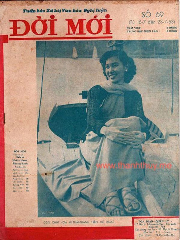
Với tôi, TT là viết tắt của Thái Thanh, cũng tương tự như MM là viết tắt của Marilyn Monroe hay BB là viết tắt của Brigitte Bardot vậy! Hình bên dưới đây: Thái Thanh trên một chiếc thuyền buồm, hồ Xuân Hương, Đà Lạt, 1953. Bên thềm năm mới, hãy nghe lại một số bài nhạc xuân do Thái Thanh trình bày!


Mất hơn 40 năm để bài hát này được cấp phép lưu hành trở lại. Nhiều năm trước, đã post nhiều về nó: ở đây, ở đây… giờ không muốn nói nhiều nữa. Những trớ trêu của lịch sử, âm nhạc chẳng phải là hội hoạ, ấy thế mà người ta vẫn đợi đến khi người nhạc sĩ qua đời lâu rồi, mới bắt đầu công nhận tài năng và giá trị các tác phẩm âm nhạc của ông ấy!
… Nhấc cao ly này, hãy chúc ngày mai sáng trời tự do. Nước non thanh bình, muôn người hạnh phúc chan hoà. Ước mơ hạnh phúc nơi nơi, hương thanh bình dâng phơi phới!
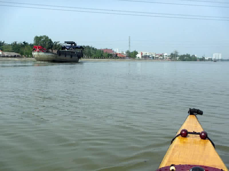
Made some more longer paddlings (20 ~ 25 km) to get to really know her, my newly – built Serene – 2. It’s not until now that I could get myself familiarized with the boat’s primary stability, which could be really “frightening” to most novice paddlers. In reality, Serene – 2 is “more stable” compared to Serene – 1, but with a much higher free board, the secondary stability comes a bit later, to assure that everything is alright!
Actually, I’m a bit concerned about the boat’s primary stability, cause it has lots of V – bottom the under side. I would need to trail the kayak in its full capacity, to really make sure that the boat reaches its expected stability when fully – loaded with gears for a multiple – days paddling trip. The “fearful, uneasy feeling” caused by the low primary stability should not be taken for granted at all, even when I know that it’s safe.
Cause you would virtually going nowhere when all the time, you’re just worrying about it, worrying that something (a potential capsize) would happen. I’m pretty sure that the boat would be fine at its designed displacement, but only trialling would tell precisely. Looking back at all my boat building, boat playing times, lots of fearful moments, lots of self – doubting, self – disappointments, self – blaming, etc…
But that’s the nature of boating things, of “adventures” on the water. It requires lots of practicing and improving, to make sure that everything is right, that everything just works. My paddling performance is really really bad lately, with very little training ever since my last 9 days paddling trip in June. Obviously, something need to be improved here, and that would be among my resolutions in the coming new year!
Made several longer paddlings (15 ~ 20 km) to see how the kayak would perform. As with all my previous boats, it takes some little time for me to adapt myself to a new boat, in particular, the primary stability. Each kayak differs by a little, after a few dozens of kilometers, I would feel more comfortable and confident with the boat’s motions. Only after that, the speed measures could be evaluated more accurately.
The Garmin GPS data shows that I could sustain about 7 kmph with my new kayak. That’s pretty much very good, though only slightly better compared to Serene – 1 (it was about 6.5+ kmph). The 7 kmph value is very closed to the average speed that other famous sea kayakers would usually make. The improvement at this point is very critical, since I can hardly make any more gain without sacrifices to the boat stability.
The weather this season is quite ideal for paddling, the temperature is dropping to around 20 ~ 25 degree (Celsius). The Northern wind is blowing, but much a lesser amplitude compared to this time last year. But too bad, I’m quite busy with my works and can’t spend much time on water, my paddling performance is not truly at its peak, so it’s still early to say more about the new kayak’s performance characteristics.
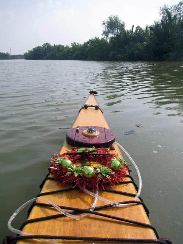
Anyway, I’m feeling very pleased with my new kayak, and I think that with more training, I could bring her to a much better performance level. Some more works required still on the kayak though, in essence, I would have to rework the USB – charging circuit, the current one is over – powered by the 3 powerful Lithium cells and wouldn’t work very well. Christmas and New Year season is coming, happy season to everyone!