Beau le bateau, dansant sur les vagues,
Ivre de vie, d’amour et de vent.
Belle la chanson naissante des vagues,
Abandonnée au sable blanc!
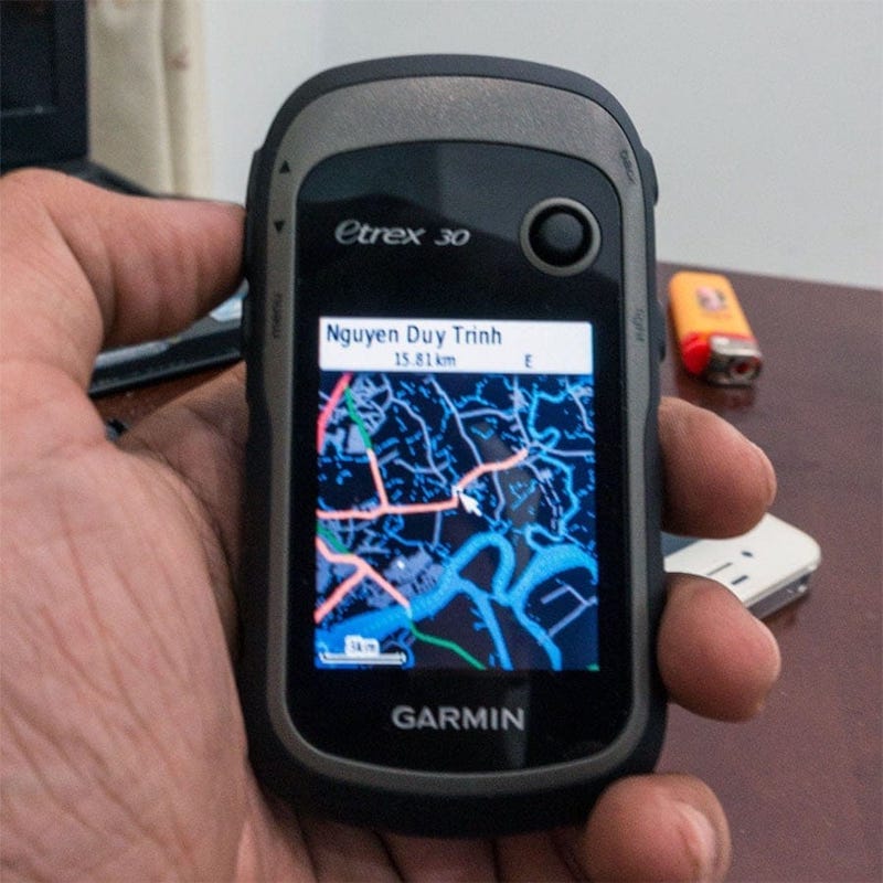
Pros: ruggedised, water – proof (to IPX – 7 standard only), good battery life (uses 2 AA batteries, I can usually make 4, 5 paddling “sorties” before having to recharge), good display (clearly visible under sunlight with low – LCD – backlight setting), doesn’t depend on cellular network to function like a cellphone, could use both GPS (US) and GLONASS[ 1 ] (Russia) satellites’ signal, good 3D – stabilized digital compass to show directions (very useful for navigating even on rivers.
Sometimes, the river is so wide that I can hardly find correct heading based solely on its 2 banks’ landmarks), large internal storage space plus the ability to add an external memory card to store more maps. Cons: the Garmin’s default map is very vague on Vietnam’s territories, next to unusable, GUI responsiveness is slow compared to a smartphone’s standard. Most importantly, correct and content – rich maps are very much demanded:
General map
I’ve replaced my Garmin’s default map by Open Street Map, which is much better. However, Open Street Map, and even Google Map, are somewhat outdated for many parts of Vietnam. I’ve found out some places which are not right, even in the very vicinity of Saigon.
Topographic map
Thanks to NASA’s satellite image projects, the topographical information is now available publicly for most part of the globe, in high resolution. I’ve found these data built – in into Open Street Map already, so “the contours” are available on my Garmin.
Hydrographic map
I’ve long been collecting hydrography data, but there’s very few of them for Vietnamese water, and most are for blue – water regions, not the brown – water. Also, I’m still seeking a way to convert those data into Garmin map format to make them usable.
Tidal charts
Garmin supports displaying tidal information (given it is in the map), but unfortunately, those information for Vietnamese water is virtually zero. For me, this is currently the most important issue. Southern VN belongs to an area with complex mix of diurnal and semi – diurnal tides (Vietnamese: nhật triều & bán nhật triều). The highs and lows of tide within a single day can differ by 2 ~ 4 meters or more, which could make paddling very difficult, or even impractical at times (e.g: spring tide at new moon phase). For now, I consult this tides4fishing.com website to do the planning prior to going to the fields.
[ 1 ] From iPhone – 4S onward, Apple includes a GLONASS receiver into its hardwares, this explains the exceptional positioning performance of the devices. In term of precision, GLONASS is better than GPS at higher latitudes, but slightly behind GPS elsewhere. The use of both systems greatly extend signal coverage: GPS alone has 31 satellites, a receiver working with both GPS and GLONASS will have support from a total number of 55 (31 + 24) satellites, which improves signal fixing time, improves tracking performance and even precision would also receive a boost.